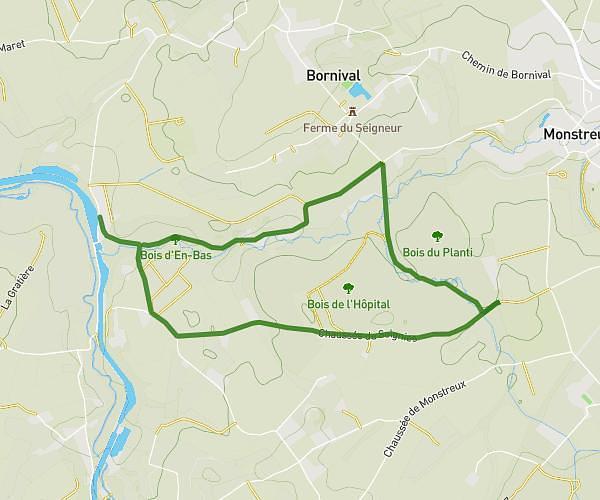
This hiking trail covers 5.852mi starting from Tubize, Walloon Brabant. The hike is a loop trail and returns to the trailhead. This hike is rated as easy, plan for about 3h18m to complete it. The route has an elevation gain of 453ft and an elevation loss of 453ft.
Etangs du Coeurcq
Route details
1.77mph
Speed
1420 kcal
Calories burned
2.9%
Avg grade
Loop trail
Route type
157ft
Min altitude
315ft
Max altitude
Route profile
453ft
Elevation gain
453ft
Elevation loss
157ft
Min altitude
315ft
Max altitude
How to get there
Trailhead: Avenue Des Coteaux 18, 1480 Tubize, Walloon Brabant, Belgium
GPS coordinates of the trailhead: 50.68095, 4.21462 / 50°40'51'' N, 4°12'52'' E