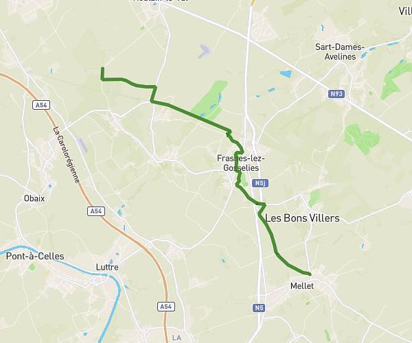
This hiking trail covers 3.412mi starting from Nivelles, Walloon Brabant. The hike does not return to the trailhead and ends near Rue Félicien Canart, 1404 Nivelles. This hike is rated as easy, plan for about 1h6m to complete it. The route has an elevation gain of 302ft and an elevation loss of 285ft.
Bois d'en bas
Route details
3.1mph
Speed
475 kcal
Calories burned
3.3%
Avg grade
Point to point
Route type
230ft
Min altitude
374ft
Max altitude
Route profile
302ft
Elevation gain
285ft
Elevation loss
230ft
Min altitude
374ft
Max altitude
How to get there
Trailhead: Rue Félicien Canart, 1404 Nivelles
GPS coordinates of the trailhead: 50.59491, 4.25253 / 50°35'41'' N, 4°15'9'' E