MapPlanner
14.348mi
Distance
3h
Duration
4.78mph
Speed
+1047ft
Elevation gain
-1056ft
Elevation loss
Hard
Level

Hallerbos

Route details

1604 kcal
Calories burned
2.8%
Avg grade
Loop trail
Route type
128ft
Min altitude
459ft
Max altitude

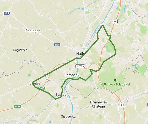
This cycling route covers 14.348mi starting from Tubize, Walloon Brabant. The ride is a loop trail and returns to the trailhead. This route is rated as hard, plan for about 3h to complete it. The route has an elevation gain of 1047ft and an elevation loss of 1056ft.

Route profile

1047ft
Elevation gain
1056ft
Elevation loss
128ft
Min altitude
459ft
Max altitude

How to get there

Trailhead: Rue Du Vignoble, 1480 Tubize

GPS coordinates of the trailhead: 50.68108, 4.2144 / 50°40'51'' N, 4°12'51'' E

Caution: May Cross Private Property

This route may pass through or near private property. Always respect posted signs, obtain permission where required, and follow local trespassing laws. MapPlanner does not guarantee public access along any route.

Safety Notice

Trail and road conditions may change without notice due to weather, construction, or other factors. Always verify current conditions before heading out. You are responsible for your own safety — follow local signage, obey traffic laws, and use your best judgment on the trail.