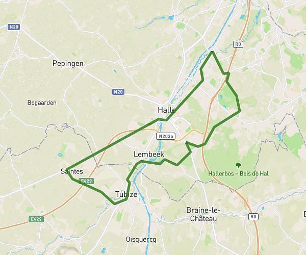
This cycling route covers 10.5mi starting from Tubize, Walloon Brabant. The ride does not return to the trailhead and ends near Pedestraat 50, 1602 Sint-Pieters-Leeuw, Flemish Brabant, Belgium. This route is rated as moderate, plan for about 45m to complete it. The route has an elevation gain of 423ft and an elevation loss of 469ft.
Honzocht vers Vlezembeek
Route details
398 kcal
Calories burned
1.6%
Avg grade
Point to point
Route type
95ft
Min altitude
262ft
Max altitude
Route profile
423ft
Elevation gain
469ft
Elevation loss
95ft
Min altitude
262ft
Max altitude
How to get there
Trailhead: Chaussée D'hondzocht 239, 1480 Tubize, Walloon Brabant, Belgium
GPS coordinates of the trailhead: 50.70193, 4.19912 / 50°42'6'' N, 4°11'56'' E