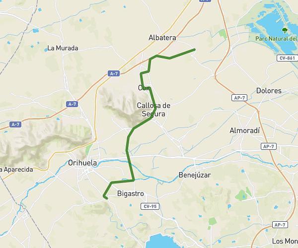
This cycling route covers 8.866mi starting from Callosa de Segura, Alicante. The ride does not return to the trailhead and ends near Calle Mayor 20, 03313 Orihuela, Alicante, Spain. This route is rated as easy, plan for about 1h30m to complete it. The route has an elevation gain of 20ft and an elevation loss of 23ft.
ess
Route details
788 kcal
Calories burned
0.1%
Avg grade
Point to point
Route type
62ft
Min altitude
82ft
Max altitude
Route profile
20ft
Elevation gain
23ft
Elevation loss
62ft
Min altitude
82ft
Max altitude
How to get there
Trailhead: Paseo De La Estación Médico Manuel Samper 53, 03360 Callosa de Segura, Alicante, Spain
GPS coordinates of the trailhead: 38.12273, -0.874644 / 38°7'21'' N, 0°52'28'' W