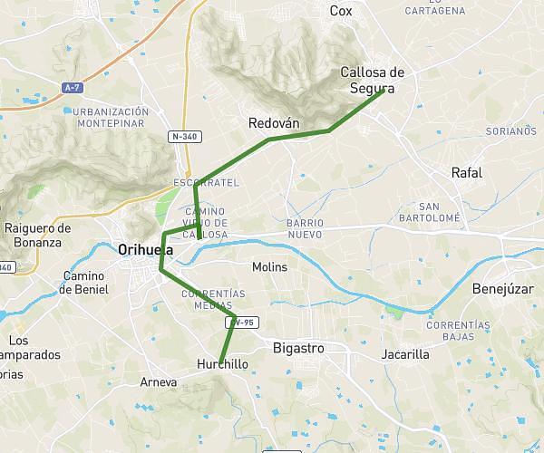
This cycling route covers 13.241mi starting from Orihuela, Alicante. The ride does not return to the trailhead and ends near Calle Remedios 3, 03349 San Isidro, Alicante, Spain. This route is rated as easy, plan for about 3h to complete it. The route has an elevation gain of 30ft and an elevation loss of 75ft.
ess
Route details
1576 kcal
Calories burned
0.2%
Avg grade
Point to point
Route type
30ft
Min altitude
75ft
Max altitude
Route profile
30ft
Elevation gain
75ft
Elevation loss
30ft
Min altitude
75ft
Max altitude
How to get there
Trailhead: Calle Horno 18, 03313 Orihuela, Alicante, Spain
GPS coordinates of the trailhead: 38.059168, -0.921947 / 38°3'33'' N, 0°55'19'' W