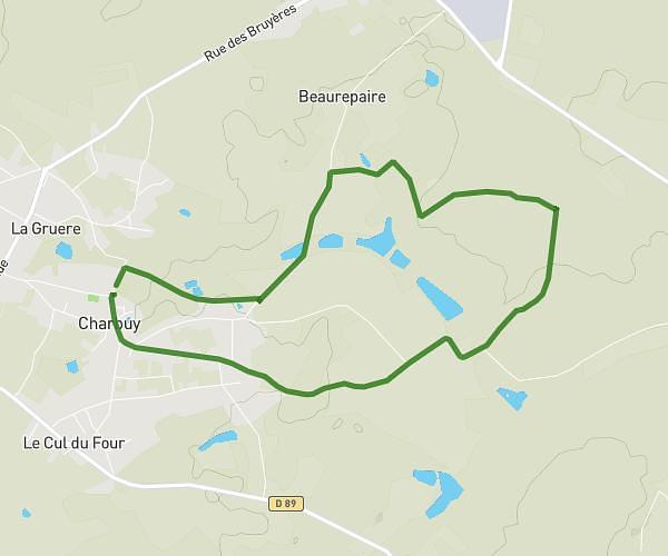
This hiking trail covers 7.359mi starting from Charbuy, Yonne. The hike is a loop trail and returns to the trailhead. This hike is rated as moderate, plan for about 3h to complete it. The route has an elevation gain of 538ft and an elevation loss of 535ft.
Pour Catherine
Route details
2.45mph
Speed
1289 kcal
Calories burned
2.8%
Avg grade
Loop trail
Route type
348ft
Min altitude
561ft
Max altitude
Route profile
538ft
Elevation gain
535ft
Elevation loss
348ft
Min altitude
561ft
Max altitude
How to get there
Trailhead: 2 Rue De La Mairie, 89113 Charbuy, France
GPS coordinates of the trailhead: 47.82458, 3.46613 / 47°49'28'' N, 3°27'58'' E