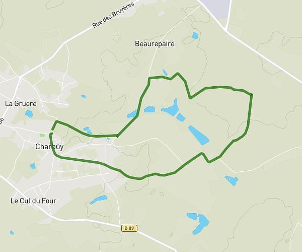
This hiking trail covers 2.037mi starting from Vergigny, Yonne. The hike is a loop trail and returns to the trailhead. This hike is rated as easy, plan for about 21m51s to complete it. The route has an elevation gain of 98ft and an elevation loss of 98ft.
Vergigny
Route details
5.59mph
Speed
155 kcal
Calories burned
1.8%
Avg grade
Loop trail
Route type
308ft
Min altitude
335ft
Max altitude
Route profile
98ft
Elevation gain
98ft
Elevation loss
308ft
Min altitude
335ft
Max altitude
How to get there
Trailhead: 63 Rue Des Bruyères, 89600 Vergigny, France
GPS coordinates of the trailhead: 47.965492, 3.721686 / 47°57'55'' N, 3°43'18'' E