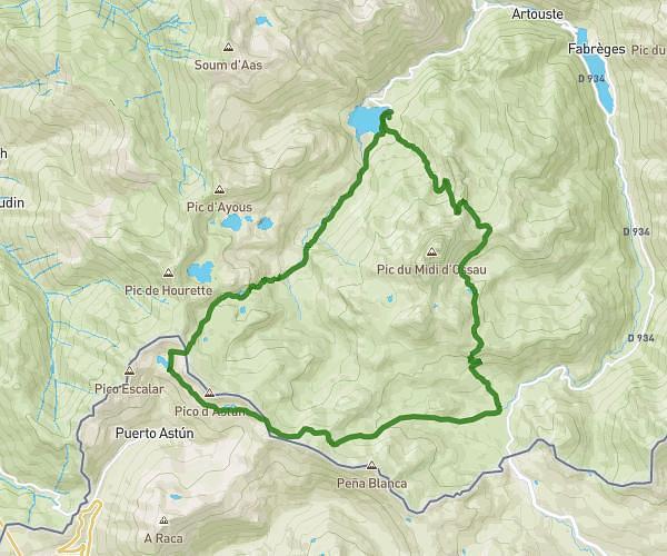
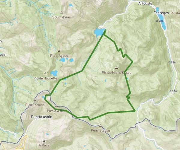
This hiking trail covers 13.811mi starting from Laruns, Pyrénées-Atlantiques. The hike is a loop trail and returns to the trailhead. This hike is rated as strenuous, plan for about 6h33m to complete it. The route has an elevation gain of 6509ft and an elevation loss of 6240ft.
tour de l'osseau
Route details
2.11mph
Speed
3160 kcal
Calories burned
17.5%
Avg grade
Loop trail
Route type
4245ft
Min altitude
8051ft
Max altitude
Steep climb
Route profile
6509ft
Elevation gain
6240ft
Elevation loss
4245ft
Min altitude
8051ft
Max altitude
How to get there
Trailhead: Route De Bious Artigues, 64440 Laruns, France
GPS coordinates of the trailhead: 42.87273, -0.44919 / 42°52'21'' N, 0°26'57'' W