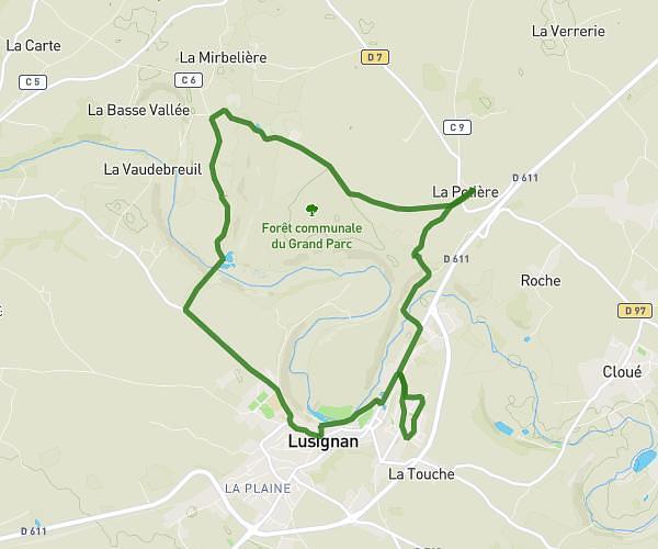
This running route covers 6.308mi starting from Valence-en-Poitou, Vienne. The run is a loop trail and returns to the trailhead. This run is rated as moderate, expect about 1h5m to complete it. The route has an elevation gain of 89ft and an elevation loss of 26ft.
FA35
Route details
5.82mph
Speed
743 kcal
Calories burned
Loop trail
Route type
364ft
Min altitude
449ft
Max altitude
Route profile
89ft
Elevation gain
26ft
Elevation loss
364ft
Min altitude
449ft
Max altitude
How to get there
Trailhead: Chemin De L'abbaye Couhé, 86700 Valence-en-Poitou
GPS coordinates of the trailhead: 46.31165, 0.1809 / 46°18'41'' N, 0°10'51'' E