This running route covers 18.639mi starting from Lévis, Quebec. The run does not return to the trailhead and ends near Route Du Président-Kennedy, G0R 3E0 Saint-Henri-de-Lévis. This run is rated as strenuous, expect about 5h to complete it. The route has an elevation gain of 262ft and an elevation loss of 207ft.
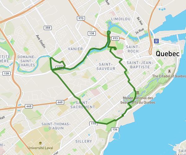
partie 1
Route details
3.73mph
Speed
3430 kcal
Calories burned
Point to point
Route type
36ft
Min altitude
299ft
Max altitude
Route profile
262ft
Elevation gain
207ft
Elevation loss
36ft
Min altitude
299ft
Max altitude
How to get there
Trailhead: Rue Thomas-Chapais, G6W 0G4 Lévis
GPS coordinates of the trailhead: 46.77966, -71.17278 / 46°46'46'' N, 71°10'22'' W