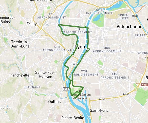
This cycling route covers 9.734mi starting from Chaponost, Rhône. The ride does not return to the trailhead and ends near 245 Cours Émile Zola, 69100 Villeurbanne, France. This route is rated as easy, plan for about 50m to complete it. The route has an elevation gain of 33ft and an elevation loss of 489ft.
JOB2
Route details
438 kcal
Calories burned
1.0%
Avg grade
Point to point
Route type
545ft
Min altitude
1024ft
Max altitude
Route profile
33ft
Elevation gain
489ft
Elevation loss
545ft
Min altitude
1024ft
Max altitude
How to get there
Trailhead: 2 La Vieille Route, 69630 Chaponost, France
GPS coordinates of the trailhead: 45.72026, 4.75969 / 45°43'12'' N, 4°45'34'' E