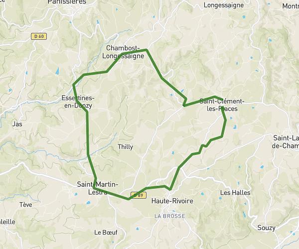
This cycling route covers 8.325mi starting from Chazelles-sur-Lyon, Loire. The ride is a loop trail and returns to the trailhead. This route is rated as hard, plan for about 50m14s to complete it. The route has an elevation gain of 1099ft and an elevation loss of 1099ft.
moi
Route details
454 kcal
Calories burned
5.0%
Avg grade
Loop trail
Route type
1814ft
Min altitude
2297ft
Max altitude
Steep climb
Route profile
1099ft
Elevation gain
1099ft
Elevation loss
1814ft
Min altitude
2297ft
Max altitude
How to get there
Trailhead: 17 Rue De La Charrantaine, 42140 Chazelles-sur-Lyon, France
GPS coordinates of the trailhead: 45.635919, 4.402335 / 45°38'9'' N, 4°24'8'' E