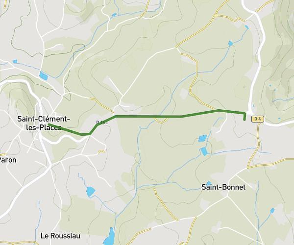
This cycling route covers 5.832mi starting from Saint-Bonnet-les-Oules, Loire. The ride does not return to the trailhead and ends near 1 Avenue De La Gare, 42480 La Fouillouse, France. This route is rated as moderate, plan for about 35m11s to complete it. The route has an elevation gain of 427ft and an elevation loss of 518ft.
Maison vers stade La Fouillouse
Route details
314 kcal
Calories burned
3.1%
Avg grade
Point to point
Route type
1329ft
Min altitude
1490ft
Max altitude
Route profile
427ft
Elevation gain
518ft
Elevation loss
1329ft
Min altitude
1490ft
Max altitude
How to get there
Trailhead: 209 Route Du Buissonnet, 42330 Saint-Bonnet-les-Oules, France
GPS coordinates of the trailhead: 45.553467, 4.327096 / 45°33'12'' N, 4°19'37'' E