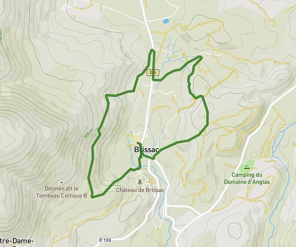
This hiking trail covers 6.999mi starting from Claret, Hérault. The hike is a loop trail and returns to the trailhead. This hike is rated as hard, plan for about 2h35m to complete it. The route has an elevation gain of 1198ft and an elevation loss of 1191ft.
DEMI CRETE TAILLADE CLARET
Route details
2.71mph
Speed
1144 kcal
Calories burned
6.5%
Avg grade
Loop trail
Route type
531ft
Min altitude
1345ft
Max altitude
Route profile
1198ft
Elevation gain
1191ft
Elevation loss
531ft
Min altitude
1345ft
Max altitude
How to get there
Trailhead: 93 Rue Des Écoles, 34270 Claret, France
GPS coordinates of the trailhead: 43.861098, 3.905189 / 43°51'39'' N, 3°54'18'' E