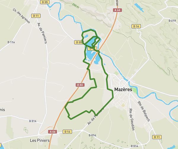
This hiking trail covers 4.303mi starting from Nailloux, Haute-Garonne. The hike is a loop trail and returns to the trailhead. This hike is rated as moderate, plan for about 1h48m to complete it. The route has an elevation gain of 594ft and an elevation loss of 597ft.
Lac de Nailloux
Route details
2.39mph
Speed
789 kcal
Calories burned
5.2%
Avg grade
Loop trail
Route type
666ft
Min altitude
945ft
Max altitude
Route profile
594ft
Elevation gain
597ft
Elevation loss
666ft
Min altitude
945ft
Max altitude
How to get there
Trailhead: 395 Chemin De Bellecoste, 31560 Nailloux, France
GPS coordinates of the trailhead: 43.35463, 1.62417 / 43°21'16'' N, 1°37'27'' E