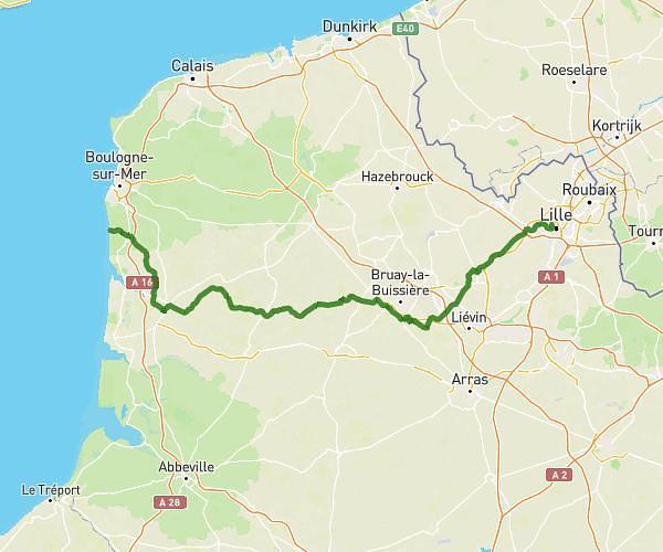
This cycling route covers 60.208mi starting from Rouvroy, Pas-de-Calais. The ride does not return to the trailhead and ends near 5 Rue De Berneville, 62123 Warlus, France. This route is rated as strenuous, plan for about to complete it. The route has an elevation gain of 656ft and an elevation loss of 381ft.
ghislain
Route details
0.3%
Avg grade
Point to point
Route type
164ft
Min altitude
505ft
Max altitude
Route profile
656ft
Elevation gain
381ft
Elevation loss
164ft
Min altitude
505ft
Max altitude
How to get there
Trailhead: 2 Rue De La Mairie, 62320 Rouvroy, France
GPS coordinates of the trailhead: 50.39306, 2.90404 / 50°23'35'' N, 2°54'14'' E