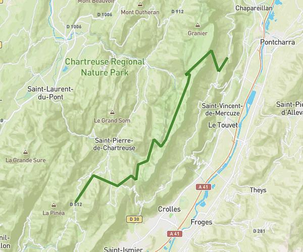
This running route covers 21.636mi starting from Sarcenas, Isère. The run does not return to the trailhead and ends near 7 Route De La Diat, 38380 Saint-Pierre-de-Chartreuse, France. This run is rated as strenuous, expect about 3h52m to complete it. The route has an elevation gain of 8668ft and an elevation loss of 9760ft.
Chartreuse Mai 26 - Etape#2
Route details
5.59mph
Speed
2653 kcal
Calories burned
Point to point
Route type
2644ft
Min altitude
6066ft
Max altitude
Route profile
8668ft
Elevation gain
9760ft
Elevation loss
2644ft
Min altitude
6066ft
Max altitude
How to get there
Trailhead: 2506 Route Du Col De Porte, 38700 Sarcenas, France
GPS coordinates of the trailhead: 45.289961, 5.766945 / 45°17'23'' N, 5°46'1'' E