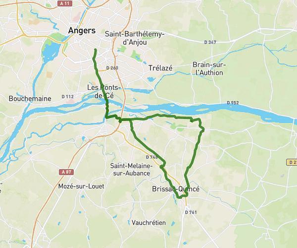
This hiking trail covers 4.855mi starting from Angers, Maine-et-Loire. The hike does not return to the trailhead and ends near 7 Rue Pierre De Coubertin, 49130 Les Ponts-de-Cé, France. This hike is rated as easy, plan for about 1h18m to complete it. The route has an elevation gain of 249ft and an elevation loss of 325ft.
08/01
Route details
3.73mph
Speed
556 kcal
Calories burned
2.2%
Avg grade
Point to point
Route type
75ft
Min altitude
180ft
Max altitude
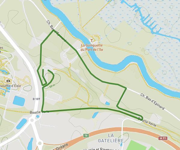
Route profile
249ft
Elevation gain
325ft
Elevation loss
75ft
Min altitude
180ft
Max altitude
How to get there
Trailhead: 4 Rue Volney, 49000 Angers, France
GPS coordinates of the trailhead: 47.462919, -0.546359 / 47°27'46'' N, 0°32'46'' W