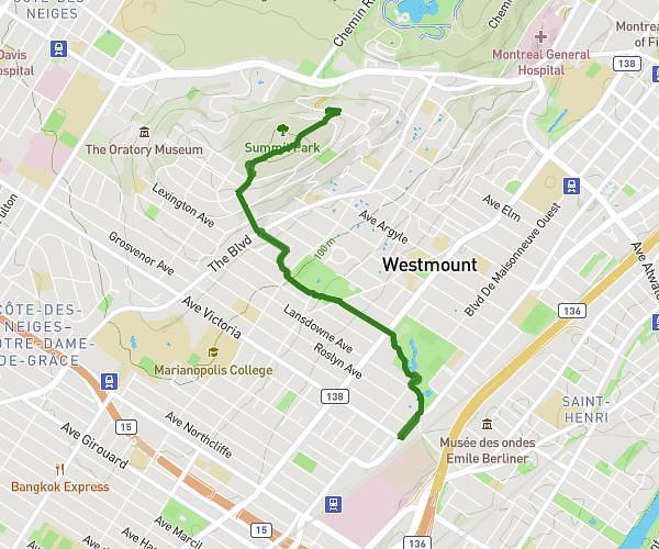
This running route covers 2.241mi starting from Westmount, Quebec. The run does not return to the trailhead and ends near Chemin Olmsted, H3A 2B4 Montréal. This run is rated as easy, expect about 21m38s to complete it. The route has an elevation gain of 492ft and an elevation loss of 417ft.
Monument Geroge-Étienne Cartier
Route details
6.21mph
Speed
247 kcal
Calories burned
Point to point
Route type
174ft
Min altitude
545ft
Max altitude
Route profile
492ft
Elevation gain
417ft
Elevation loss
174ft
Min altitude
545ft
Max altitude
How to get there
Trailhead: Chemin De Casson, H3Y 2H1 Westmount
GPS coordinates of the trailhead: 45.49057, -73.59105 / 45°29'26'' N, 73°35'27'' W