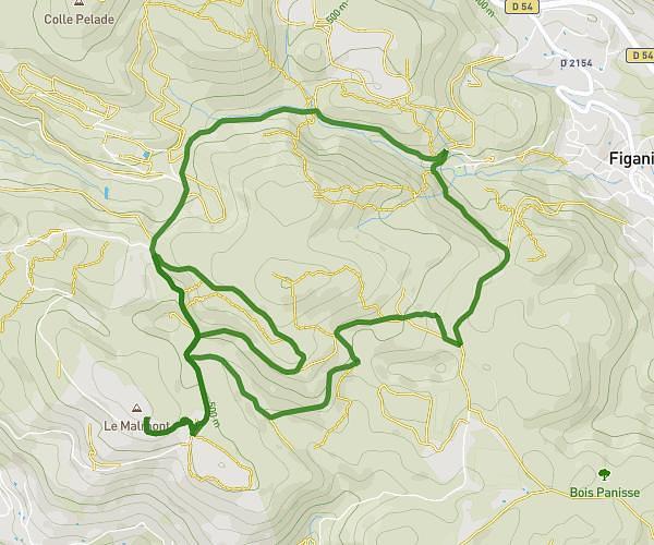
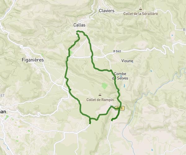
This running route covers 12.823mi starting from Callas, Var. The run is a loop trail and returns to the trailhead. This run is rated as strenuous, expect about 2h17m to complete it. The route has an elevation gain of 246ft and an elevation loss of 384ft.
Semi trail plat
Route details
5.59mph
Speed
1573 kcal
Calories burned
Loop trail
Route type
942ft
Min altitude
1194ft
Max altitude
Route profile
246ft
Elevation gain
384ft
Elevation loss
942ft
Min altitude
1194ft
Max altitude
How to get there
Trailhead: 2223 Rd 25, 83830 Callas, France
GPS coordinates of the trailhead: 43.58849, 6.5369 / 43°35'18'' N, 6°32'12'' E