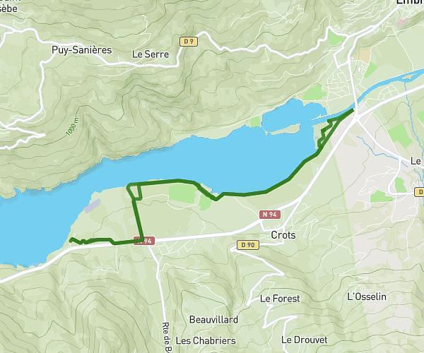
This running route covers 3.308mi starting from Gap, Hautes-Alpes. The run is a loop trail and returns to the trailhead. This run is rated as easy, expect about 43m15s to complete it. The route has an elevation gain of 138ft and an elevation loss of 138ft.
Mon parcours
Route details
4.59mph
Speed
494 kcal
Calories burned
Loop trail
Route type
2428ft
Min altitude
2539ft
Max altitude
Route profile
138ft
Elevation gain
138ft
Elevation loss
2428ft
Min altitude
2539ft
Max altitude
How to get there
Trailhead: Rue Des Tilleuls, 05000 Gap
GPS coordinates of the trailhead: 44.56438, 6.10895 / 44°33'51'' N, 6°6'32'' E