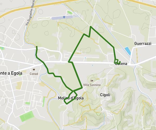
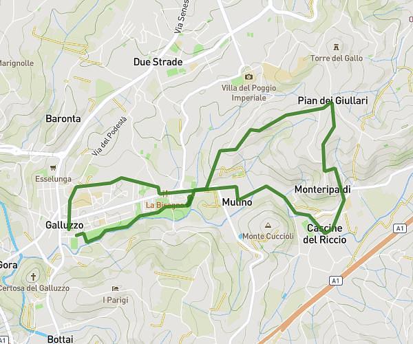
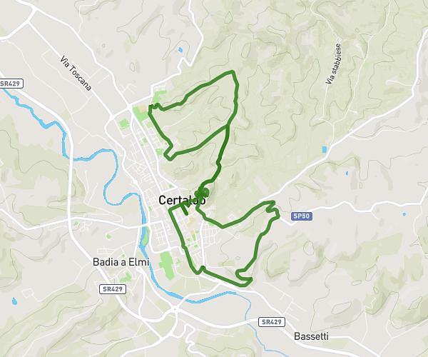
This running route covers 6.283mi starting from Montespertoli, Florence. The run is a loop trail and returns to the trailhead. This run is rated as moderate, expect about 50m33s to complete it. The route has an elevation gain of 745ft and an elevation loss of 745ft.
Percorso gara del Vino Montespertoli
Route details
7.46mph
Speed
578 kcal
Calories burned
Loop trail
Route type
686ft
Min altitude
840ft
Max altitude
Route profile
745ft
Elevation gain
745ft
Elevation loss
686ft
Min altitude
840ft
Max altitude
How to get there
Trailhead: Piazza Del Popolo 66, 50025 Montespertoli Florence, Italy
GPS coordinates of the trailhead: 43.6432, 11.07527 / 43°38'35'' N, 11°4'30'' E