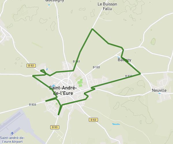
This running route covers 3.311mi starting from Mesnils-sur-Iton, Eure. The run is a loop trail and returns to the trailhead. This run is rated as easy, expect about 35m to complete it. The route has an elevation gain of 13ft and an elevation loss of 20ft.
Ebroicienne
Route details
5.68mph
Speed
400 kcal
Calories burned
Loop trail
Route type
495ft
Min altitude
515ft
Max altitude
Route profile
13ft
Elevation gain
20ft
Elevation loss
495ft
Min altitude
515ft
Max altitude
How to get there
Trailhead: 17 Rue Des Bruyères, 27240 Mesnils-sur-Iton, France
GPS coordinates of the trailhead: 48.85855, 1.13967 / 48°51'30'' N, 1°8'22'' E