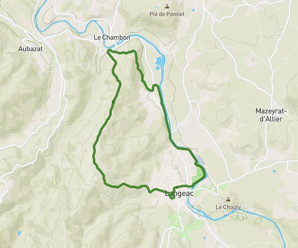
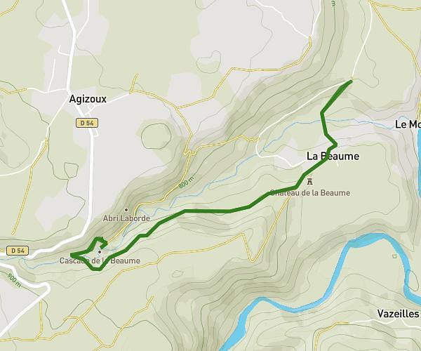
This hiking trail covers 4.224mi starting from Langeac, Haute-Loire. The hike is a loop trail and returns to the trailhead. This hike is rated as moderate, plan for about 1h38m to complete it. The route has an elevation gain of 866ft and an elevation loss of 863ft.
Petite boucle randonnée 2026
Route details
2.57mph
Speed
735 kcal
Calories burned
7.8%
Avg grade
Loop trail
Route type
1650ft
Min altitude
2267ft
Max altitude
Route profile
866ft
Elevation gain
863ft
Elevation loss
1650ft
Min altitude
2267ft
Max altitude
How to get there
Trailhead: 17 Rue Jean Baptiste Tuja, 43300 Langeac, France
GPS coordinates of the trailhead: 45.102, 3.49516 / 45°6'7'' N, 3°29'42'' E