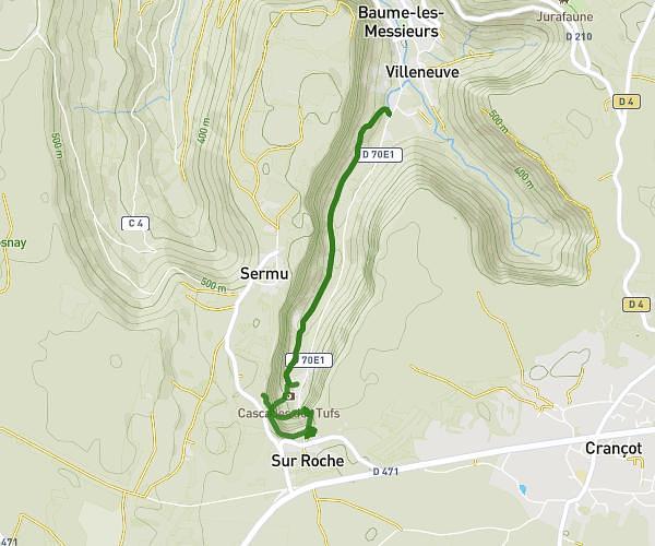
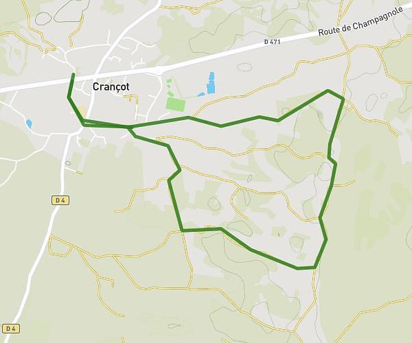
This hiking trail covers 3.628mi starting from Publy, Jura. The hike is a loop trail and returns to the trailhead. This hike is rated as moderate, plan for about 47m to complete it. The route has an elevation gain of 741ft and an elevation loss of 774ft.
Binans 2
Route details
4.63mph
Speed
350 kcal
Calories burned
7.9%
Avg grade
Loop trail
Route type
1762ft
Min altitude
2119ft
Max altitude
Route profile
741ft
Elevation gain
774ft
Elevation loss
1762ft
Min altitude
2119ft
Max altitude
How to get there
Trailhead: Rue De La Chapelle, 39570 Publy
GPS coordinates of the trailhead: 46.6289, 5.66228 / 46°37'44'' N, 5°39'44'' E