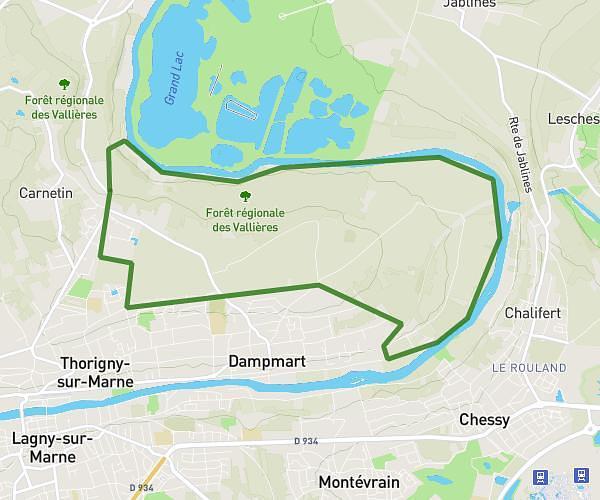
This hiking trail covers 2.862mi starting from Lagny-sur-Marne, Seine-et-Marne. The hike is a loop trail and returns to the trailhead. This hike is rated as easy, plan for about 50m to complete it. The route has an elevation gain of 246ft and an elevation loss of 249ft.
Gouvernes, chemin de la ferraille
Route details
3.44mph
Speed
359 kcal
Calories burned
3.3%
Avg grade
Loop trail
Route type
171ft
Min altitude
341ft
Max altitude
Route profile
246ft
Elevation gain
249ft
Elevation loss
171ft
Min altitude
341ft
Max altitude
How to get there
Trailhead: 21 Chemin Des Touvents, 77400 Lagny-sur-Marne, France
GPS coordinates of the trailhead: 48.8684, 2.70466 / 48°52'6'' N, 2°42'16'' E