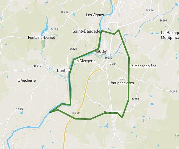
This running route covers 4.309mi starting from Ambrières-les-Vallées, Mayenne. The run is a loop trail and returns to the trailhead. This run is rated as easy, expect about 1h35m to complete it. The route has an elevation gain of 92ft and an elevation loss of 95ft.
Lundi 19 fevrier
Route details
2.72mph
Speed
1086 kcal
Calories burned
Loop trail
Route type
338ft
Min altitude
410ft
Max altitude
Route profile
92ft
Elevation gain
95ft
Elevation loss
338ft
Min altitude
410ft
Max altitude
How to get there
Trailhead: 5d Rue De La Courtille, 53300 Ambrières-les-Vallées, France
GPS coordinates of the trailhead: 48.399236, -0.625767 / 48°23'57'' N, 0°37'32'' W