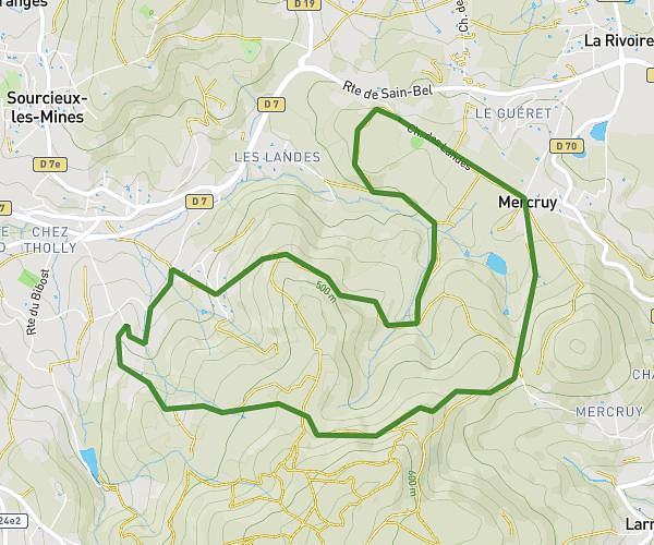
This hiking trail covers 5.137mi starting from Sainte-Paule, Rhône. The hike is a loop trail and returns to the trailhead. This hike is rated as hard, plan for about 2h4m to complete it. The route has an elevation gain of 1070ft and an elevation loss of 1073ft.
Boucle Col du Châtoux
Route details
2.49mph
Speed
925 kcal
Calories burned
7.9%
Avg grade
Loop trail
Route type
2126ft
Min altitude
2841ft
Max altitude
Route profile
1070ft
Elevation gain
1073ft
Elevation loss
2126ft
Min altitude
2841ft
Max altitude
How to get there
Trailhead: 2080 Route De Châtoux, 69620 Sainte-Paule, France
GPS coordinates of the trailhead: 45.988637, 4.565168 / 45°59'19'' N, 4°33'54'' E