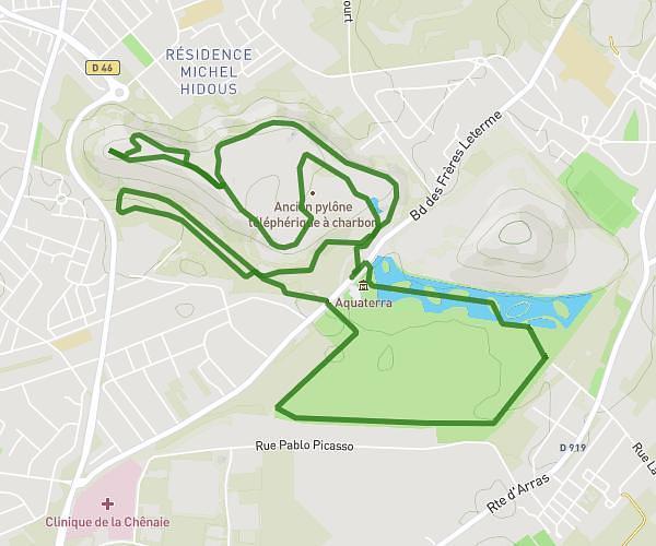
This running route covers 9.077mi starting from Thumeries, Nord. The run is a loop trail and returns to the trailhead. This run is rated as hard, expect about 1h30m to complete it. The route has an elevation gain of 131ft and an elevation loss of 138ft.
Parcours valloné Mons-en-Pévèle
Route details
6.05mph
Speed
1029 kcal
Calories burned
Loop trail
Route type
151ft
Min altitude
226ft
Max altitude
Route profile
131ft
Elevation gain
138ft
Elevation loss
151ft
Min altitude
226ft
Max altitude
How to get there
Trailhead: 56 Rue Émile Zola, 59239 Thumeries, France
GPS coordinates of the trailhead: 50.47833, 3.06555 / 50°28'41'' N, 3°3'55'' E