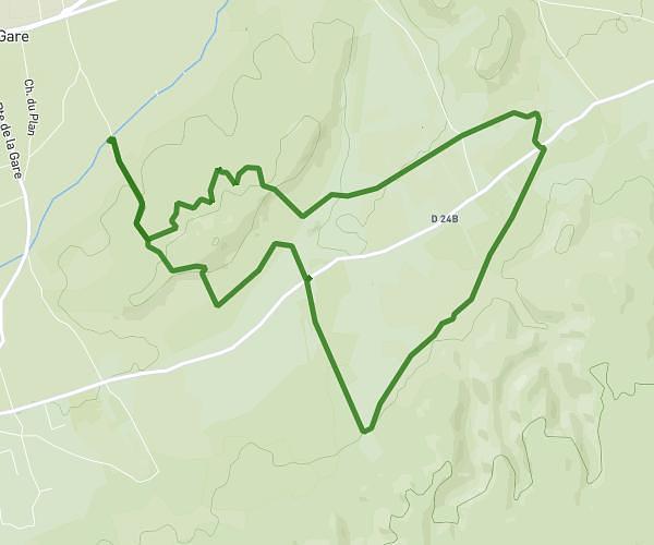
This running route covers 11.29mi starting from Entraigues-sur-la-Sorgue, Vaucluse. The run does not return to the trailhead and ends near 651 Chemin Du Plan Du Milieu, 84700 Sorgues, France. This run is rated as strenuous, expect about 1h45m to complete it. The route has an elevation gain of 59ft and an elevation loss of 43ft.
ENTRAIGUES 18K
Route details
6.46mph
Speed
1201 kcal
Calories burned
Point to point
Route type
89ft
Min altitude
144ft
Max altitude
Route profile
59ft
Elevation gain
43ft
Elevation loss
89ft
Min altitude
144ft
Max altitude
How to get there
Trailhead: 30 Allée Des Belles Dames, 84320 Entraigues-sur-la-Sorgue, France
GPS coordinates of the trailhead: 44.00156, 4.91099 / 44°0'5'' N, 4°54'39'' E