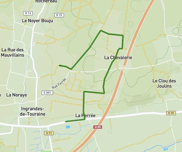
This walking route covers 3.431mi starting from Beaumont-en-Véron, Indre-et-Loire. The walk is a loop trail and returns to the trailhead. This walk is rated as moderate, plan for about 1h34m to complete it. The route has an elevation gain of 213ft and an elevation loss of 213ft.
puy besnard chinonais coté
Route details
27:35/mi
Pace
386 kcal
Calories burned
Loop trail
Route type
151ft
Min altitude
285ft
Max altitude
Route profile
213ft
Elevation gain
213ft
Elevation loss
151ft
Min altitude
285ft
Max altitude
How to get there
Trailhead: Chemin Du Carroi Du Noyer Pigeon Au Carroi De La Palenne, 37420 Chinon, France
GPS coordinates of the trailhead: 47.1944, 0.21774 / 47°11'39'' N, 0°13'3'' E