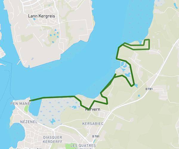
This running route covers 6.649mi starting from Riantec, Morbihan. The run is a loop trail and returns to the trailhead. This run is rated as moderate, expect about 1h12m to complete it. The route has an elevation gain of 325ft and an elevation loss of 322ft.
RIANTEC/PLOUHINEC
Route details
5.54mph
Speed
823 kcal
Calories burned
Loop trail
Route type
0ft
Min altitude
72ft
Max altitude
Route profile
325ft
Elevation gain
322ft
Elevation loss
0ft
Min altitude
72ft
Max altitude
How to get there
Trailhead: 42 Rue De Kerpunce, 56670 Riantec, France
GPS coordinates of the trailhead: 47.703006, -3.29696 / 47°42'10'' N, 3°17'49'' W