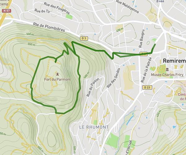
This hiking trail covers 3.058mi starting from Girmont-Val-d'Ajol, Vosges. The hike is a loop trail and returns to the trailhead. This hike is rated as easy, plan for about 1h10m to complete it. The route has an elevation gain of 344ft and an elevation loss of 344ft.
girmont le plateau
Route details
2.62mph
Speed
507 kcal
Calories burned
4.3%
Avg grade
Loop trail
Route type
2185ft
Min altitude
2395ft
Max altitude
Route profile
344ft
Elevation gain
344ft
Elevation loss
2185ft
Min altitude
2395ft
Max altitude
How to get there
Trailhead: 31 Route De Clairegoutte, 88340 Girmont-Val-d'Ajol, France
GPS coordinates of the trailhead: 47.943625, 6.558585 / 47°56'37'' N, 6°33'30'' E