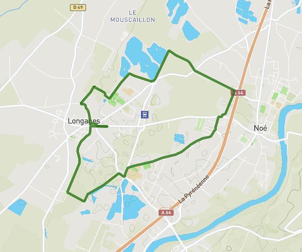
This running route covers 9.459mi starting from Ambax, Haute-Garonne. The run is a loop trail and returns to the trailhead. This run is rated as hard, expect about 2h to complete it. The route has an elevation gain of 1168ft and an elevation loss of 1198ft.
tour de Ambax
Route details
4.73mph
Speed
1372 kcal
Calories burned
Loop trail
Route type
659ft
Min altitude
1109ft
Max altitude
Route profile
1168ft
Elevation gain
1198ft
Elevation loss
659ft
Min altitude
1109ft
Max altitude
How to get there
Trailhead: 36 Chemin De Labade, 31230 Ambax, France
GPS coordinates of the trailhead: 43.37748, 0.92875 / 43°22'38'' N, 0°55'43'' E