MapPlanner
13.442mi
Distance
4h
Duration
+1155ft
Elevation gain
-2608ft
Elevation loss
Strenuous
Level

2023 05 30 Ronceveaux - Zubiri

Route details

3.36mph
Speed
1726 kcal
Calories burned
5.3%
Avg grade
Point to point
Route type
1729ft
Min altitude
3189ft
Max altitude

This hiking trail covers 13.442mi starting from Orreaga, Navarre. The hike does not return to the trailhead and ends near Orreagako Etorbidea 39, 31630 Esteribar, Navarre, Spain. This hike is rated as strenuous, plan for about 4h to complete it. The route has an elevation gain of 1155ft and an elevation loss of 2608ft.

Description of the route by the creator

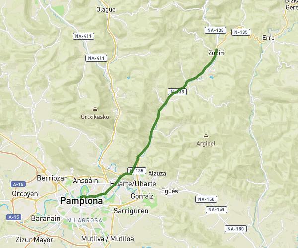
On Tuesday evening, he arrived in Zubiri after a 22 km journey and not too much ascent. When I got him on the phone, he told me he'd arrived 4 hours ahead of schedule 🤭🤣

(Description automatically translated)

Route profile

1155ft
Elevation gain
2608ft
Elevation loss
1729ft
Min altitude
3189ft
Max altitude

How to get there

Trailhead: Orreagako Gure Anderea Karrika 17, 31650 Orreaga, Navarre, Spain

GPS coordinates of the trailhead: 43.00979, -1.32037 / 43°0'35'' N, 1°19'13'' W

Caution: May Cross Private Property

This route may pass through or near private property. Always respect posted signs, obtain permission where required, and follow local trespassing laws. MapPlanner does not guarantee public access along any route.

Safety Notice

Trail and road conditions may change without notice due to weather, construction, or other factors. Always verify current conditions before heading out. You are responsible for your own safety — follow local signage, obey traffic laws, and use your best judgment on the trail.