MapPlanner
14.356mi
Distance
10h9m
Duration
+3740ft
Elevation gain
-1086ft
Elevation loss
Hard
Level

2023 05 29 St Jean Pied de Port - Ronceveaux

Route details

1.42mph
Speed
4614 kcal
Calories burned
6.4%
Avg grade
Point to point
Route type
541ft
Min altitude
3468ft
Max altitude

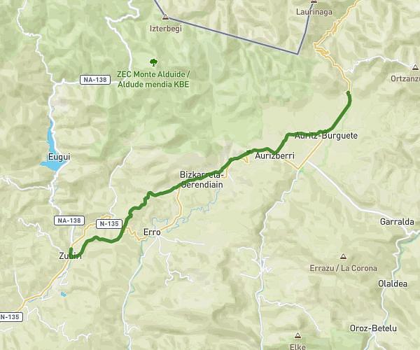
This hiking trail covers 14.356mi starting from Saint-Jean-Pied-de-Port, Pyrénées-Atlantiques. The hike does not return to the trailhead and ends near Iruña - Frantzia (Luzaide) Errepidea / Carretera Pamplona - Francia (Valcarlos), 31650 Orreaga. This hike is rated as hard, plan for about 10h9m to complete it. The route has an elevation gain of 3740ft and an elevation loss of 1086ft.

Description of the route by the creator

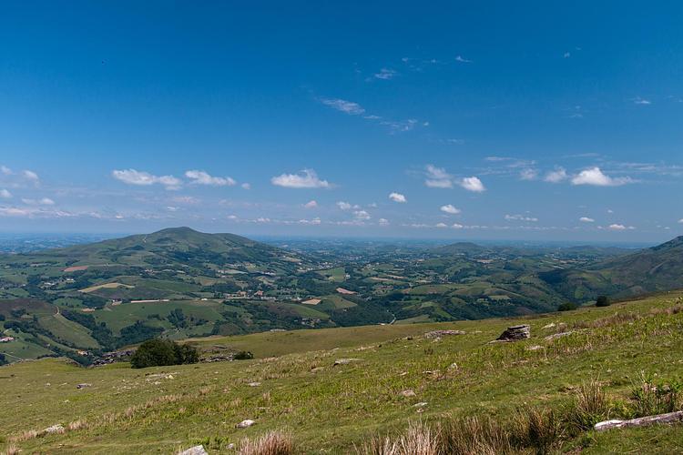
So hello everyone! news from our dear Pilgrim: on the first day, Monday, as you've all heard by now, he did Garazi - Roncesvalles: it was quite a climb (from 570m to 1350m over 24 km). That's pretty hard for a beginner! 😰

(Description automatically translated)

Route profile

3740ft
Elevation gain
1086ft
Elevation loss
541ft
Min altitude
3468ft
Max altitude

How to get there

Trailhead: Avenue Renaud, 64220 Saint-Jean-Pied-de-Port

GPS coordinates of the trailhead: 43.16414, -1.23814 / 43°9'50'' N, 1°14'17'' W

Caution: May Cross Private Property

This route may pass through or near private property. Always respect posted signs, obtain permission where required, and follow local trespassing laws. MapPlanner does not guarantee public access along any route.

Safety Notice

Trail and road conditions may change without notice due to weather, construction, or other factors. Always verify current conditions before heading out. You are responsible for your own safety — follow local signage, obey traffic laws, and use your best judgment on the trail.