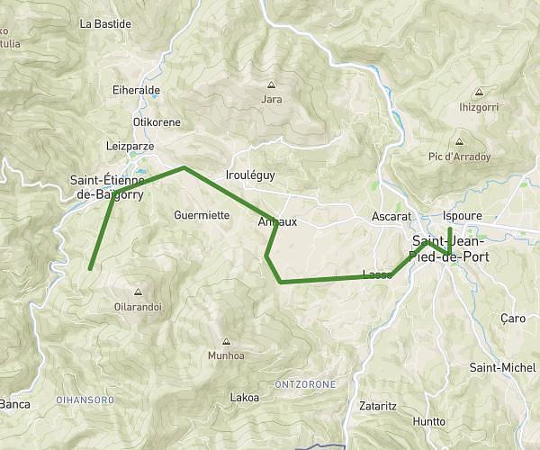
This hiking trail covers 7.153mi starting from Hasparren, Pyrénées-Atlantiques. The hike is a loop trail and returns to the trailhead. This hike is rated as moderate, plan for about 2h52m to complete it. The route has an elevation gain of 869ft and an elevation loss of 863ft.
Elizaberry
Route details
2.49mph
Speed
1255 kcal
Calories burned
4.6%
Avg grade
Loop trail
Route type
207ft
Min altitude
587ft
Max altitude
Route profile
869ft
Elevation gain
863ft
Elevation loss
207ft
Min altitude
587ft
Max altitude
How to get there
Trailhead: 451 Chemin D'uharteborda, 64240 Hasparren, France
GPS coordinates of the trailhead: 43.38319, -1.3554 / 43°22'59'' N, 1°21'19'' W