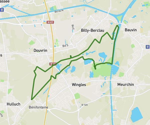
This hiking trail covers 5.747mi starting from Bauvin, Nord. The hike does not return to the trailhead and ends near Rue Étienne Dolet, 59221 Provin. This hike is rated as easy, plan for about 1h25m to complete it. The route has an elevation gain of 213ft and an elevation loss of 220ft.
Bauvin/meurchin
Route details
4.06mph
Speed
602 kcal
Calories burned
1.4%
Avg grade
Point to point
Route type
59ft
Min altitude
102ft
Max altitude
Route profile
213ft
Elevation gain
220ft
Elevation loss
59ft
Min altitude
102ft
Max altitude
How to get there
Trailhead: Résidence Jules Sauvage, 59221 Bauvin
GPS coordinates of the trailhead: 50.51559, 2.90336 / 50°30'56'' N, 2°54'12'' E