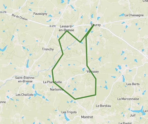
This running route covers 13.512mi starting from Thurey, Saône-et-Loire. The run is a loop trail and returns to the trailhead. This run is rated as strenuous, expect about 2h25m to complete it. The route has an elevation gain of 499ft and an elevation loss of 499ft.
Prépa semi
Route details
5.59mph
Speed
1658 kcal
Calories burned
Loop trail
Route type
600ft
Min altitude
692ft
Max altitude
Route profile
499ft
Elevation gain
499ft
Elevation loss
600ft
Min altitude
692ft
Max altitude
How to get there
Trailhead: 5 Route De Chalon, 71440 Thurey, France
GPS coordinates of the trailhead: 46.74324, 5.12003 / 46°44'35'' N, 5°7'12'' E