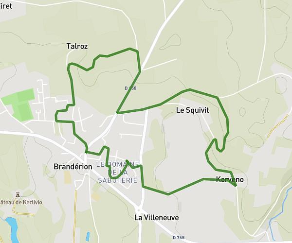
This running route covers 1.462mi starting from Hennebont, Morbihan. The run is a loop trail and returns to the trailhead. This run is rated as easy, expect about 15m48s to complete it. The route has an elevation gain of 89ft and an elevation loss of 85ft.
Hennebont test
Route details
5.56mph
Speed
181 kcal
Calories burned
Loop trail
Route type
49ft
Min altitude
118ft
Max altitude
Route profile
89ft
Elevation gain
85ft
Elevation loss
49ft
Min altitude
118ft
Max altitude
How to get there
Trailhead: Avenue Pasteur, 56700 Hennebont
GPS coordinates of the trailhead: 47.80617, -3.28761 / 47°48'22'' N, 3°17'15'' W