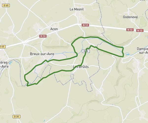
This hiking trail covers 10.419mi starting from Acon, Eure. The hike is a loop trail and returns to the trailhead. This hike is rated as moderate, plan for about 3h10m to complete it. The route has an elevation gain of 597ft and an elevation loss of 604ft.
Islou - Prudemanche
Route details
3.29mph
Speed
1354 kcal
Calories burned
2.2%
Avg grade
Loop trail
Route type
374ft
Min altitude
584ft
Max altitude
Route profile
597ft
Elevation gain
604ft
Elevation loss
374ft
Min altitude
584ft
Max altitude
How to get there
Trailhead: Rue Du Pressoir, 27570 Acon
GPS coordinates of the trailhead: 48.75721, 1.10745 / 48°45'25'' N, 1°6'26'' E