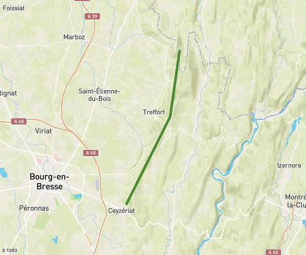
This hiking trail covers 12.076mi starting from Ceyzériat, Ain. The hike does not return to the trailhead and ends near Chemin Du Mont Myon, 39320 Val Suran, France. This hike is rated as strenuous, plan for about 4h51m to complete it. The route has an elevation gain of 2395ft and an elevation loss of 1831ft.
Mont july mont myon
Route details
2.49mph
Speed
2168 kcal
Calories burned
6.6%
Avg grade
Point to point
Route type
1217ft
Min altitude
2195ft
Max altitude
Route profile
2395ft
Elevation gain
1831ft
Elevation loss
1217ft
Min altitude
2195ft
Max altitude
How to get there
Trailhead: 30 Place Du Mont July, 01250 Ceyzériat, France
GPS coordinates of the trailhead: 46.183724, 5.331121 / 46°11'1'' N, 5°19'52'' E