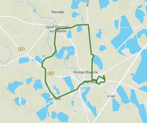
This hiking trail covers 5.753mi starting from Marlieux, Ain. The hike is a loop trail and returns to the trailhead. This hike is rated as easy, plan for about 1h25m to complete it. The route has an elevation gain of 276ft and an elevation loss of 276ft.
Beaumont/ La tuile/ st germain +
Route details
4.04mph
Speed
607 kcal
Calories burned
1.8%
Avg grade
Loop trail
Route type
850ft
Min altitude
928ft
Max altitude
Route profile
276ft
Elevation gain
276ft
Elevation loss
850ft
Min altitude
928ft
Max altitude
How to get there
Trailhead: 218 Rue Du Lotissement Le Bourg, 01240 Marlieux, France
GPS coordinates of the trailhead: 46.066179, 5.077213 / 46°3'58'' N, 5°4'37'' E