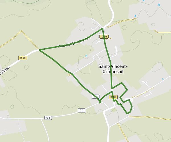
This walking route covers 1.23mi starting from Sandouville, Seine-Maritime. The walk is a loop trail and returns to the trailhead. This walk is rated as easy, plan for about 26m to complete it. The route has an elevation gain of 69ft and an elevation loss of 62ft.
sandouville
Route details
21:08/mi
Pace
106 kcal
Calories burned
Loop trail
Route type
305ft
Min altitude
344ft
Max altitude
Route profile
69ft
Elevation gain
62ft
Elevation loss
305ft
Min altitude
344ft
Max altitude
How to get there
Trailhead: 50 Rue De L'église, 76430 Sandouville, France
GPS coordinates of the trailhead: 49.49715, 0.31836 / 49°29'49'' N, 0°19'6'' E