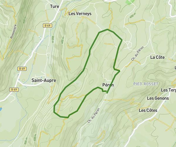
This running route covers 2.961mi starting from Merlas, Isère. The run is a loop trail and returns to the trailhead. This run is rated as easy, expect about 32m to complete it. The route has an elevation gain of 308ft and an elevation loss of 282ft.
Monchâteau saint sixte
Route details
5.56mph
Speed
366 kcal
Calories burned
Loop trail
Route type
2398ft
Min altitude
2677ft
Max altitude
Route profile
308ft
Elevation gain
282ft
Elevation loss
2398ft
Min altitude
2677ft
Max altitude
How to get there
Trailhead: 1020 Route Du Mas Du Mont, 38620 Merlas, France
GPS coordinates of the trailhead: 45.42616, 5.647404 / 45°25'34'' N, 5°38'50'' E