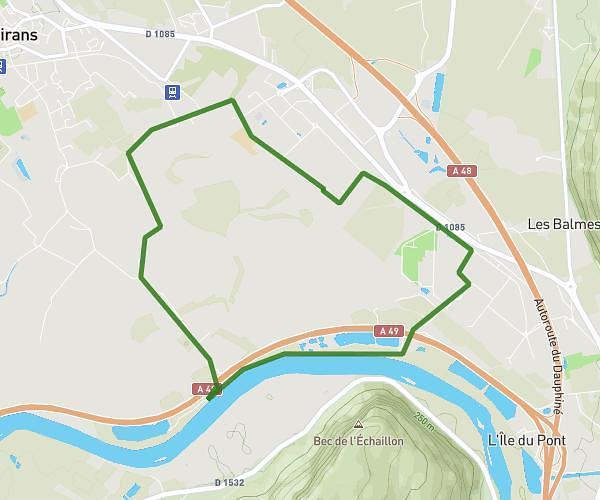
This running route covers 5.84mi starting from Voreppe, Isère. The run is a loop trail and returns to the trailhead. This run is rated as moderate, expect about 1h2m to complete it. The route has an elevation gain of 279ft and an elevation loss of 285ft.
aline et aude
Route details
5.59mph
Speed
716 kcal
Calories burned
Loop trail
Route type
604ft
Min altitude
643ft
Max altitude
Route profile
279ft
Elevation gain
285ft
Elevation loss
604ft
Min altitude
643ft
Max altitude
How to get there
Trailhead: 455 Rue Du Pommarin, 38340 Voreppe, France
GPS coordinates of the trailhead: 45.315121, 5.597269 / 45°18'54'' N, 5°35'50'' E