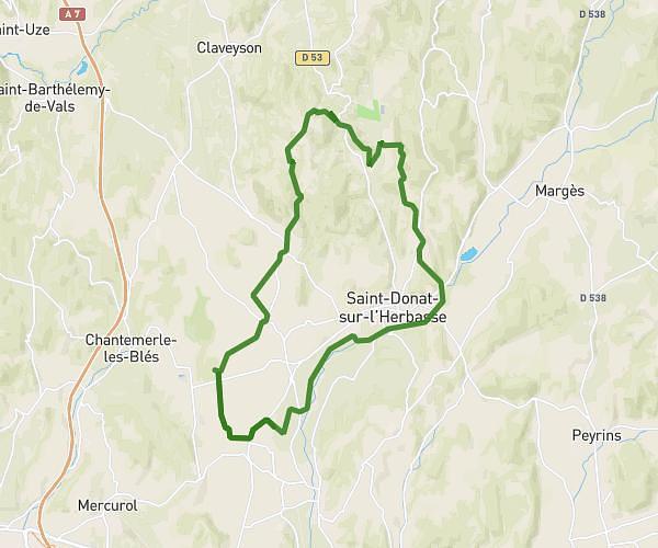
This hiking trail covers 9.952mi starting from Tain-l'Hermitage, Drôme. The hike does not return to the trailhead and ends near 14 Place Du Taurobole, 26600 Tain-l'Hermitage, France. This hike is rated as moderate, plan for about 1h51m to complete it. The route has an elevation gain of 1775ft and an elevation loss of 1772ft.
TAIN
Route details
5.38mph
Speed
821 kcal
Calories burned
6.7%
Avg grade
Point to point
Route type
0ft
Min altitude
1093ft
Max altitude
Route profile
1775ft
Elevation gain
1772ft
Elevation loss
0ft
Min altitude
1093ft
Max altitude
How to get there
Trailhead: 62 Avenue Jules Nadi, 26600 Tain-l'Hermitage, France
GPS coordinates of the trailhead: 45.070264, 4.845058 / 45°4'12'' N, 4°50'42'' E