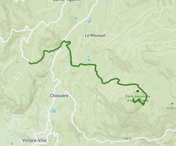
This running route covers 7.696mi starting from Tours-sur-Meymont, Puy-de-Dôme. The run is a loop trail and returns to the trailhead. This run is rated as hard, expect about 1h23m to complete it. The route has an elevation gain of 299ft and an elevation loss of 469ft.
Tour sur Meymont
Route details
5.56mph
Speed
950 kcal
Calories burned
Loop trail
Route type
1575ft
Min altitude
1978ft
Max altitude
Route profile
299ft
Elevation gain
469ft
Elevation loss
1575ft
Min altitude
1978ft
Max altitude
How to get there
Trailhead: Chemin Du Bost, 63590 Tours-sur-Meymont, France
GPS coordinates of the trailhead: 45.678545, 3.590659 / 45°40'42'' N, 3°35'26'' E