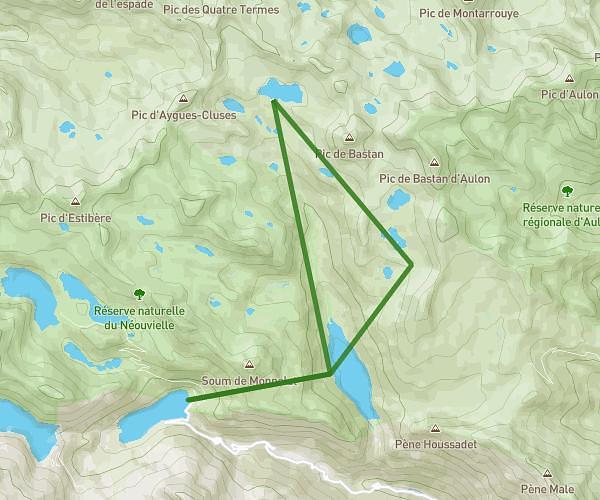
This hiking trail covers 8.758mi starting from Cauterets, Hautes-Pyrénées. The hike is a loop trail and returns to the trailhead. This hike is rated as strenuous, plan for about 7h19m to complete it. The route has an elevation gain of 4534ft and an elevation loss of 4465ft.
20250630_Lac d'Estom
Route details
1.19mph
Speed
3581 kcal
Calories burned
19.5%
Avg grade
Loop trail
Route type
4583ft
Min altitude
6204ft
Max altitude
Steep climb
Route profile
4534ft
Elevation gain
4465ft
Elevation loss
4583ft
Min altitude
6204ft
Max altitude
How to get there
Trailhead: 65110, Cauterets, Hautes-Pyrénées, France
GPS coordinates of the trailhead: 42.85417, -0.09804 / 42°51'15'' N, 0°5'52'' W